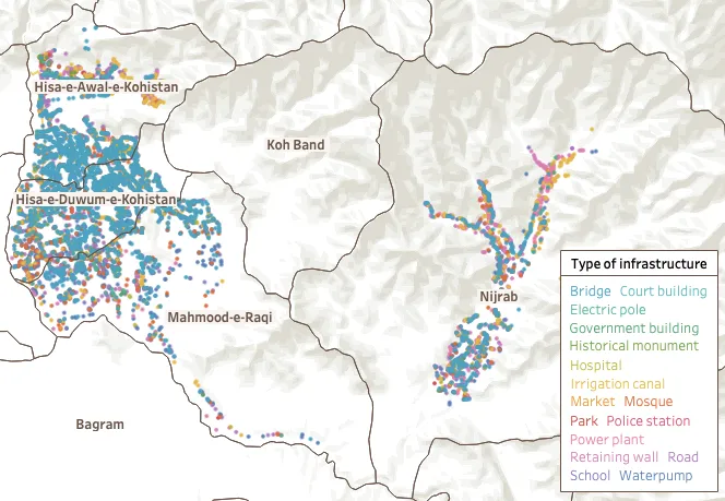
A public infrastructure census became a reusable evidence base.
7,883 infrastructures were mapped over 24 months by 89 enumerators using GPS coordinates, images, questionnaires, water-quality tests and metadata.
Once structured, infrastructure data supported comparisons and further analysis around conditions, maintenance, water quality, access, geography, donors and budgets.
- 7,883
- infrastructures
- 89
- enumerators
- 24
- months